Download this portfolio as PDF
Gerardo Ezequiel Martín Carreño
Cloud geospatial systems, reproducible analysis and interfaces built for decisions.
me@gerardoezequiel.xyz · gerardoezequiel.xyz · linkedin.com/in/gerardoezequiel · London
CommunityAI
Open-data architecture, spatial validation and governed release controls for area-level evidence.
As CTO-designate within the collaborative founding team, I set the technology and data direction and led the open-data rebuild. I develop bespoke spatial models to explore audience geography, location choices and media allocation within the proof of concept. I designed the data architecture, source and licence records, spatial validation and release checks, and built a test of whether candidate signals add predictive value beyond agreed baselines, keeping customer-specific validation separate.
As CTO-designate within the collaborative founding team, I set the technology and data direction and led the open-data rebuild. I develop bespoke spatial models to explore audience geography, location choices and media allocation within the proof of concept. I designed the data architecture, source and licence records, spatial validation and release checks, and built a test of whether candidate signals add predictive value beyond agreed baselines, keeping customer-specific validation separate.
- CTO-designate mandate following a technical audit and staged platform roadmap.
- An open-data architecture with documented sources, processing and model provenance.
- Spatial holdouts and baseline comparisons built into validation.
- Release controls distinguishing research outputs from customer-specific validation.
Where the work stands: This case describes my technical mandate within a founding team, not ownership or proven customer impact. Detailed architecture and results remain confidential. Predictive signals do not establish causal effects.
Climate Intelligence
Climate-data integration, geospatial interfaces and a sourced assessment API.
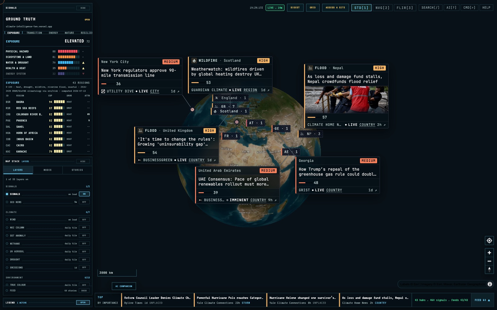
I developed the climate console, source adapters and Site Assess API, building on an earlier situational-awareness concept. I connected map layers, a Sentinel-2 preview through STAC and a per-location assessment that records its sources and missing coverage. I also exposed the same functions through read-only tools for agent access.
I developed the climate console, source adapters and Site Assess API, building on an earlier situational-awareness concept. I connected map layers, a Sentinel-2 preview through STAC and a per-location assessment that records its sources and missing coverage. I also exposed the same functions through read-only tools for agent access.
- An implemented map console for climate, hazard and energy context.
- Source adapters and a per-location assessment API with missing-data handling.
- Documented coastal and wildfire screening proxies, kept distinct from validated hazard models.
- A read-only agent tool surface and a catalogue of sources and licence conditions.
Where the work stands: An exploratory screening prototype. Coastal exposure uses an elevation proxy and wildfire screening uses hot/dry conditions; neither is a full hazard model. The tool does not estimate insured loss or establish financial risk, commercial adoption or continuously live data.
Shaping Cool Cities
Reproducible data-fusion pipeline across 40,344 analysis cells in six European cities.
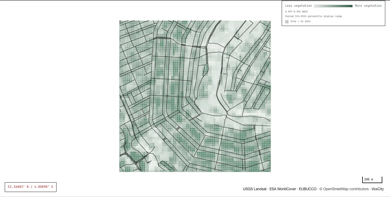
I built a Python pipeline aligning Landsat temperature and vegetation data, VoxCity urban-form measures, Urbanity street networks and Global Streetscapes image semantics, with EUBUCCO building footprints. I trained exploratory XGBoost models and used SHAP to inspect associations. A later audit identified problems in the temperature target and spatial folds; I am rebuilding those stages before publishing performance claims.
I built a Python pipeline aligning Landsat temperature and vegetation data, VoxCity urban-form measures, Urbanity street networks and Global Streetscapes image semantics, with EUBUCCO building footprints. I trained exploratory XGBoost models and used SHAP to inspect associations. A later audit identified problems in the temperature target and spatial folds; I am rebuilding those stages before publishing performance claims.
- An integrated source table for 40,344 cells across Amsterdam, Athens, Barcelona, Berlin, Madrid and Paris, with stable city and grid identifiers.
- A public PMTiles field for inspecting selected inputs, with source hashes and a published manifest.
- A methods audit recording the target, coordinate-feature and fold-design defects that must be corrected before performance is published.
Where the work stands: Model validation is being rebuilt after my own re-audit found problems in the temperature target and in how the spatial cross-validation folds were separated. Until that work is finished, no model score, explanation or cooling scenario here is a validated claim.