Build with Gerardo
Let’s build something useful for climate and cities.
I bring environmental science, geospatial data and software engineering together. I would like to meet people with a different perspective, a problem they understand deeply and the curiosity to explore it together.
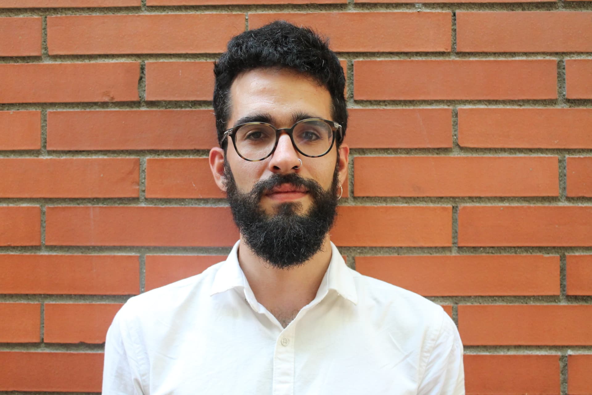
Based in London, with roots in the Canary Islands. Currently participating in Carbon13.
At a glance
- Founder type
- Technical: software, data and modelling, with environmental science behind it.
- Based
- London, and in Cambridge and London for the programme blocks.
- Commitment
- Part-time while we test directions. Full-time once the venture is funded.
- Looking for
- Customer understanding, commercial experience or deep scientific and industry knowledge.
From understanding a system to building the software.
At CommunityAI, my work spans solution architecture, geospatial data engineering, modelling and software delivery. I enjoy connecting technical direction with the details of making a system work.
My strongest cloud experience is with GCP and cloud-native geospatial tools. I like building systems that can scale, while keeping the first experiment focused on a real question.
- CommunityAI, LondonChief Technology Officer (Designate)2026–present
- Set the technology and data direction for an early-stage community-intelligence proof of concept, developing bespoke spatial models for location intelligence and media-optimisation questions. Led an open-data rebuild with spatial validation, provenance, licence governance and reproducible release controls.
- TJX Europe, LondonFull-Stack Spatial Data ScientistSep 2023–May 2026
- Delivered geospatial analysis for European markets and built cloud-native workflows connecting loyalty, footfall and demographic evidence. Automated site-selection, catchment and cannibalisation analysis that had required weeks of manual work.
- Metabolism of Cities · Horizon 2020 CityLoops, from LondonResearcher and Spatial Data AnalystFeb 2022–Feb 2023
- Co-developed and co-authored CityLoops' Urban Circularity Assessment method; managed two analysts.
From spatial data to working software.
01
Cloud-native geospatial
From Earth observation to queryable spatial evidence.
- Google Cloud (GCP)
- BigQuery
- Earth Engine
- Cloud Storage
- Terraform
02
Spatial data engineering
Pipelines and open formats that keep data usable.
- Python
- SQL
- PostGIS
- DuckDB
- dbt
- GeoParquet
- PMTiles
03
Geospatial ML & science
Environmental features, spatial validation and reproducible models.
- GeoPandas
- NumPy
- scikit-learn
- XGBoost
- Vertex AI
- VoxCity
04
Interfaces & cartography
Make complex geography legible, interactive and useful.
- TypeScript
- React
- Next.js
- MapLibre
- deck.gl
- Three.js
One model. Many ways of seeing.
The same place read three ways: the climate acting on it, the assets laid over it and the decisions that connect them. How a place is represented decides which problems become visible, so this is where I start.
How can cities adapt to a warmer world?
Urban heat, climate risk and the built environment. I am interested in how spatial evidence helps us understand exposure, compare interventions and decide what to change about the places we live.
Explore the urban climate researchThree directions. Each with a way to be wrong.
These are hypotheses I am testing through Carbon13, not products and not a roadmap. Each one names who might pay for it, why location changes the answer, what the first experiment would be and the question that would stop it.
I would rather hear that a direction is wrong than agree politely about it. If you have worked on one of these problems, the last question in each is the one worth answering.
And if a conversation produces a fourth direction that replaces all three, that is the better result. I am looking for someone to choose a problem with, not someone to sell one of these.
All three come from the same method, The Living Section: five questions I put to any place (Enough, Room, Limits, Known, Kept). The directions are where a company could start; the method is how I would keep it clear about what it knows and what it only assumes.
Climate risk and finance
Climate evidence people can act on.
Connect climate-risk information to real assets and the decisions around them. I am interested in where clearer spatial evidence could improve investment, due diligence and financial disclosure.
What site evidence is missing before a lender can use a climate-risk report?
See the Climate Intelligence console- What already exists
- A working console: map layers for climate, hazards and energy, a per-location screening assessment that records its sources and missing coverage, and the same functions exposed as read-only agent tools.
- Who would buy it
- A commercial-property lender or technical adviser reviewing a purchase or refinancing.
- Why location matters
- An approximate address can miss the right building, its flood protection or local site conditions.
- What I would bring
- I can connect asset locations, source data and a reviewable interface. We would need someone who knows credit decisions and model acceptance.
- What I am missing
- Property lending, credit risk or technical due-diligence experience.
- A first experiment
- Review five authorised past property files with a lending specialist. Count the meaningful evidence gaps and compare review effort with the current process.
Where this could fall apart
Do these evidence gaps delay or change lending decisions often enough for someone to pay to resolve them?
Answer this from your experienceBuildings and heat
Cooler places. Less energy.
Use climate and spatial evidence to help building owners choose upgrades that reduce overheating and energy demand. A place to connect my heat research with practical engineering.
Which upgrade could reduce overheating without increasing energy use?
See the urban heat research- Who would buy it
- An office-estate owner with a cooling replacement or refurbishment decision coming up.
- Why location matters
- Neighbouring buildings, sun exposure and shade change which upgrades make sense.
- What I would bring
- I can build the spatial analysis and the decision tool. We would need building-physics judgement and customer knowledge alongside it.
- What I am missing
- Building-services or estates experience, with insight into how owners choose and buy upgrades.
- A first experiment
- Review one building and three options with its owner and engineer. Compare our recommendation with their existing plan.
Where this could fall apart
Would better spatial evidence change the chosen upgrade, or does the existing engineer already have everything they need?
Answer this from your experienceIndustry, water and energy
Understand the place. Use fewer resources.
Help industrial sites understand the trade-offs between heat, water and energy. The opportunity is to turn local environmental constraints into better operating and investment choices.
Which cooling option balances water, energy and reliable operation?
- Who would buy it
- A cold-storage operator planning to replace or expand a cooling system.
- Why location matters
- Heat conditions, the water source and local supply constraints change the options available to a site.
- What I would bring
- I can connect environmental and spatial evidence to a usable comparison. We would need plant operations and cooling-system expertise.
- What I am missing
- Industrial cooling, water or process engineering, with knowledge of operating sites.
- A first experiment
- Compare two real replacement options at one authorised facility. Ask the operator and engineer whether the extra evidence changes their choice.
Where this could fall apart
Does location change the equipment choice, or are operating loads and supplier specifications already enough?
Answer this from your experience
Shared direction. Room to think.
I would value a co-founder who brings customer understanding, commercial experience or deep scientific and industry knowledge. We should both have space to contribute and challenge each other.
A hybrid rhythm
I value time together and focused asynchronous work. Regular conversations help us think through decisions; clear notes give each of us room to make progress.
A roadmap we define together
I like working in sprints, with a shared vision and mission. We agree what matters, build towards it and stay flexible when the evidence changes.
Curiosity in both directions
I am always learning and enjoy being challenged technically and intellectually. I want us to question assumptions, share what we learn and make something small together before deciding on a bigger commitment.
- What I am doing alongside this
- I am Chief Technology Officer (Designate) at CommunityAI and building geospatial.careers. Both are real commitments, and I would rather say so than have you find out later. Carbon13 has my focus for the directions we test; the venture gets all of it once it is funded.
- Where I can be, and when
- London, and in Cambridge and London in person for the programme blocks. I would want us to spend real time in the same room early, not only on calls.
- How I would like to start
- A Climatask together, then two or three more weeks on the same problem before either of us commits to anything. A deadline, a disagreement and a setback tell you more about a partnership than any number of good conversations.
The city is also somewhere to walk, notice and question.
More about my backgroundMy academic work began with environmental systems and urban metabolism: understanding how cities use materials, energy and resources. At Metabolism of Cities, I co-developed and co-authored the CityLoops Urban Circularity Assessment methodology.
Street photography and art are part of how I reflect on my practice. They encourage me to notice what a dataset leaves out, question familiar representations and stay curious about how people experience a place.
Explore the creative side of my workA few things I am working on.
Explore the work, my contribution and its current stage.
Building
Geospatial Careers
A career workspace, in development, that takes geospatial professionals from a PDF CV through saved roles to DOCX applications and learning priorities.
Working prototype
Climate Intelligence
One map console for a place’s climate hazards, energy systems and environmental exposure, with a per-location screening API over open sources.
Ongoing research
Shaping Cool Cities
A 40,344-cell research dataset joining satellite heat, 3D urban form and street-level evidence across six European cities, with model validation being rebuilt.
Start with a conversation.
Tell me what you are exploring, what you would enjoy building and what you would like to ask. No CV or questionnaire needed.
Email me to arrange a first chat. Evenings can work too; suggest a couple of times and your time zone.
Want a starting point? Draft a short introduction.
All questions are optional. Your answers stay in this tab and disappear when you leave. Nothing is submitted to this website.
An observation, an early idea or a question is enough.
Your experience, a responsibility you enjoy or a different perspective.
Skills, judgement or a way of working you would value.
Location, time together, focused work or anything we should discuss.
A short example or a public link, if you would like to share it.
Something you are curious about or would like to challenge.
The draft is optional and stays in your tab until you choose to copy, download or open it in your email app. Website privacy.