Download this portfolio as PDF
Gerardo Ezequiel Martín Carreño
Critical cartography and situated interfaces: the map and the walk as medium.
me@gerardoezequiel.xyz · gerardoezequiel.xyz · linkedin.com/in/gerardoezequiel · London
Dérive
A walking instrument that records the street's sensory texture, the layer data leaves out.
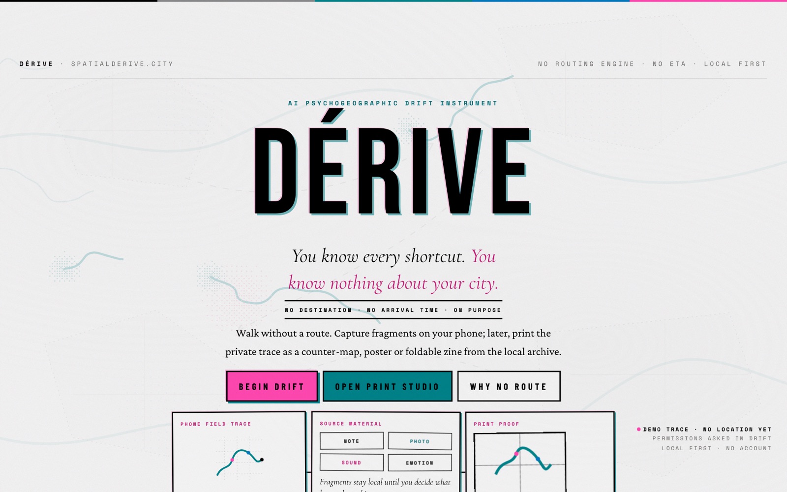
I designed and built Dérive as a mobile app with local storage, prompts, field notes and cartographic outputs. A route stays connected to the fragments collected along it, and the archive can become a countermap, structured dataset or foldable zine. I developed the visual identity and the relationship between screen, street and paper alongside the software.
I designed and built Dérive as a mobile app with local storage, prompts, field notes and cartographic outputs. A route stays connected to the fragments collected along it, and the archive can become a countermap, structured dataset or foldable zine. I developed the visual identity and the relationship between screen, street and paper alongside the software.
- A mobile web app with local persistence through IndexedDB.
- Implemented map, data and zine exports, including print-ready foldable PDFs.
- A public interface study demonstrating how a walk can be read through routes, fragments and annotations.
- Two workshop editions prepared as pilots, with their readiness stated in the project.
Where the work stands: The workshop editions remain pilots, and the atlas includes a labelled demonstration rather than completed participant research. Experimental sensor measures are not validated research findings.
Upside Down World
An interactive atlas and poster-making tool that makes map orientation a choice the reader can question.
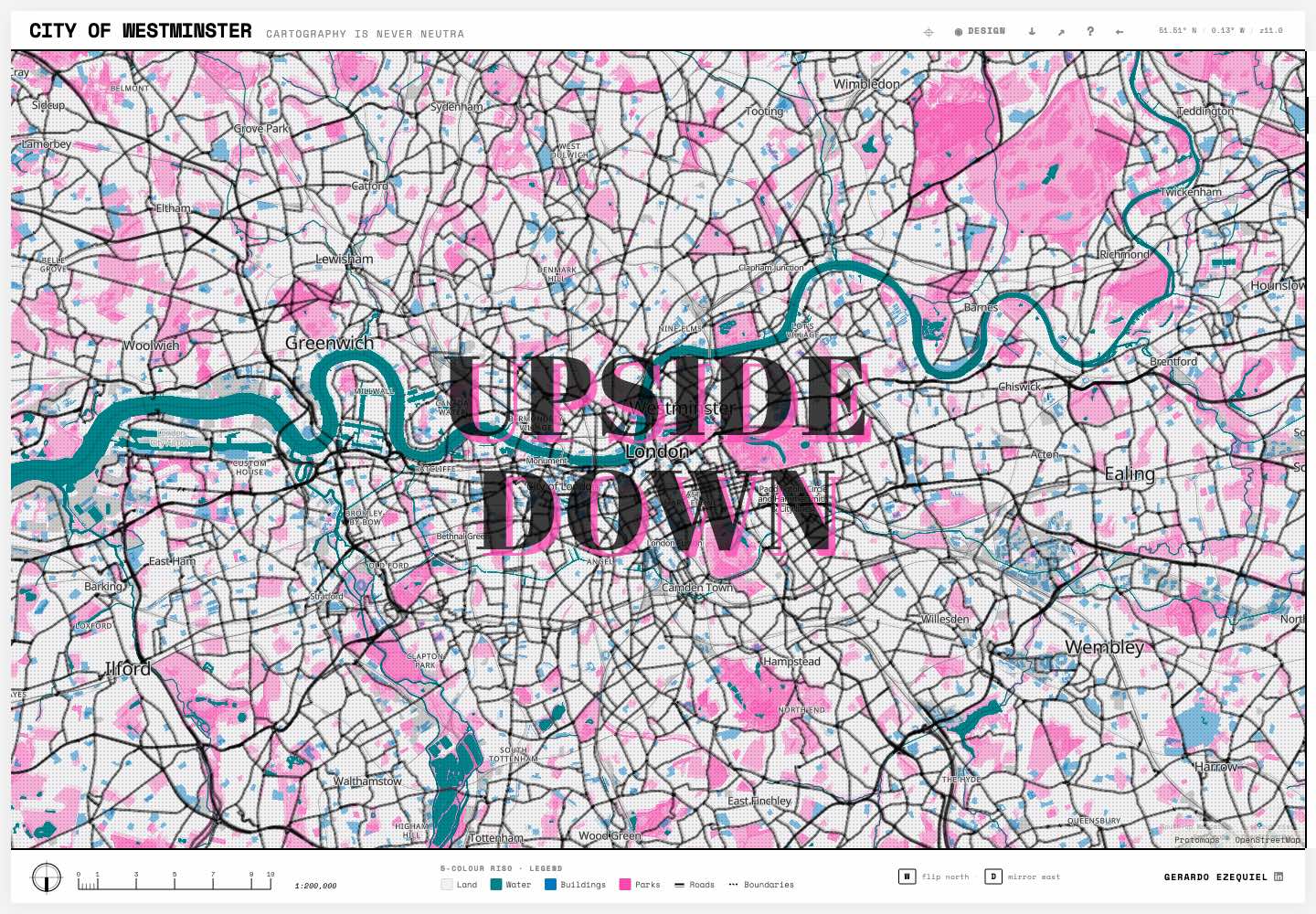
I built the interactive mapper, projection controls and poster-making workflow. The interface connects north-up and south-up views with styling, editable text and print formats. I developed a visual language drawn from spot-colour printing, so the same cartographic idea can be explored in the browser and taken away as a poster.
I built the interactive mapper, projection controls and poster-making workflow. The interface connects north-up and south-up views with styling, editable text and print formats. I developed a visual language drawn from spot-colour printing, so the same cartographic idea can be explored in the browser and taken away as a poster.
- A public interactive atlas at upsidedown.earth.
- Implemented projection and orientation controls with editable typography.
- A poster export workflow supporting A4, A3, A2 and social formats.
Where the work stands: An artistic and educational tool, not a neutral representation of the world. Changing orientation does not remove projection distortion.
Twenty Years on the Lower Lea
A walking workshop reading twenty years of Olympic Park regeneration critically.
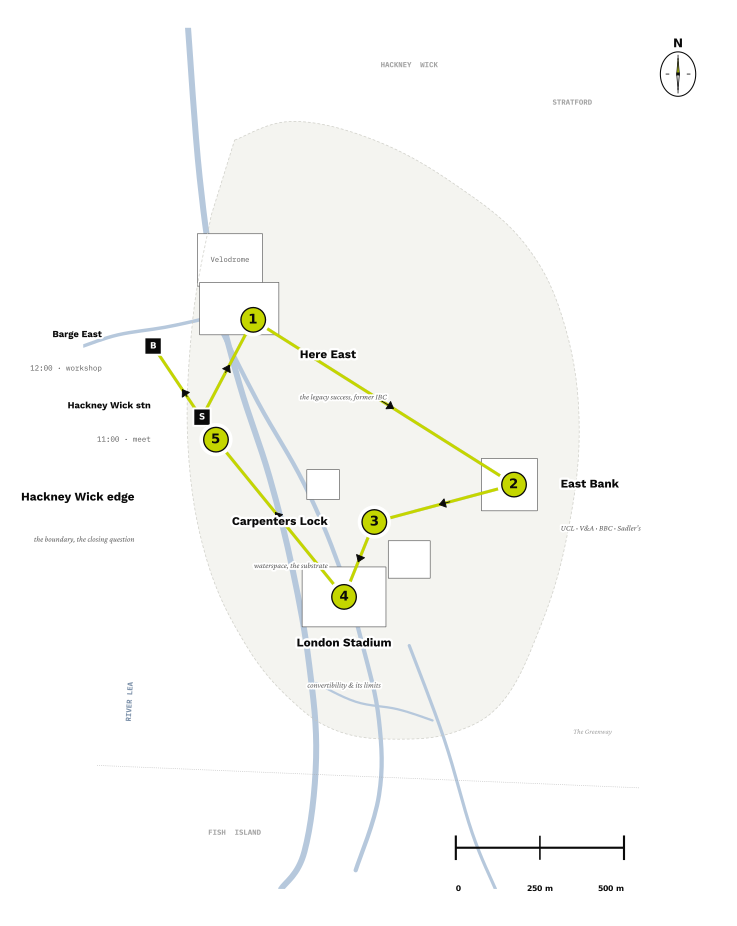
I conceived, designed and built a five-stop route, a 15-page print companion and a mobile workshop interface. I paired engineering accounts with cited critical readings, and created tools for voting, notes, photographs and voice recordings. The app connects contributions to a shared display; local updates and a retry queue support interrupted connectivity. I developed the work through critique and delivered it collaboratively.
I conceived, designed and built a five-stop route, a 15-page print companion and a mobile workshop interface. I paired engineering accounts with cited critical readings, and created tools for voting, notes, photographs and voice recordings. The app connects contributions to a shared display; local updates and a retry queue support interrupted connectivity. I developed the work through critique and delivered it collaboratively.
- A live two-hour walking workshop delivered for a built-environment practice’s Cities and Infrastructure team.
- A 15-page A4 companion and standalone vector route map, with PDF, SVG and PNG outputs.
- A mobile companion with voting, field capture, shared display and local retry behaviour.
- Cited critical readings and engineering references woven through the route, print and interface.
Where the work stands: The work was developed through critique and delivered collaboratively. The commissioner, co-host and participant contributions remain private. A group of around twenty-five was the design target, not independently audited attendance; the live event interface is not a public showcase.